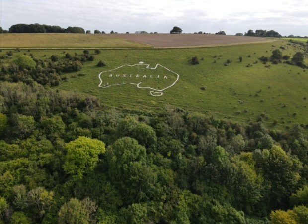
During the First World War, farmland near the village of Compton Chamberlayne, Wiltshire became a large military camp known as Hurdcott Camp. It was one of three large camps located between the villages of Compton Chamberlayne and Sutton Mandeville and provided vital training and convalescent facilities. The name Hurdcott came from one of the farms on which the camp stood.
Hurdcott was taken over by the Australian Imperial Force in March 1917 and became Command Depot No. 3, a convalescent camp for Australian soldiers recovering from illness and wounds having been discharged from military hospitals. In early 1917, soldiers (following the example of other chalk carvings at nearby Fovant and Sutton Mandeville) dug out an outline of Australia, with the legend “AUSTRALIA” inside, into the northern slope of Compton Down.
Many of these soldiers never made it home. The Map of Australia has in the past gone through periods of decline and restoration but most recently was abandoned since 2005 and could no longer be seen.

The Map of Australia in 1952
